

3. The art of Navigation
“Marine navigation is a blend of both science and art. A key union between the knowledge of theory, the application of mathematics and the exercise of seafaring instincts that have proven to be the crucial elements behind successful maritime voyages for millennia” (Bowditch, The American Practical Navigator, first published in 1802).
When first learning navigation it is easy to mix-up the tools used for navigation with navigation itself. Navigation is the process in the mind of the navigator, what is our position, where do we want to go, and maybe most importantly, where do we specifically not want to be.
Out on the ocean an estimated position within 30nm is quite adequate, while during pilotage in the Channel Islands the margins are very small. It is up to the navigator to choose the most suitable tools to determine the yacht’s position.
The tools at our disposal are amongst others charts, hand-bearing compass, buoyage, depth, gps, radar, local knowledge or simply dead reckoning. The prudent navigator has a filled toolbox, and chooses the best mix for the situation.
The present gps-plotters (or any other integrated navigation system with an electronic chart) provide a powerful tool for navigation. As navigator you should be aware of the limits of the system, but that will be discussed in a later topic.
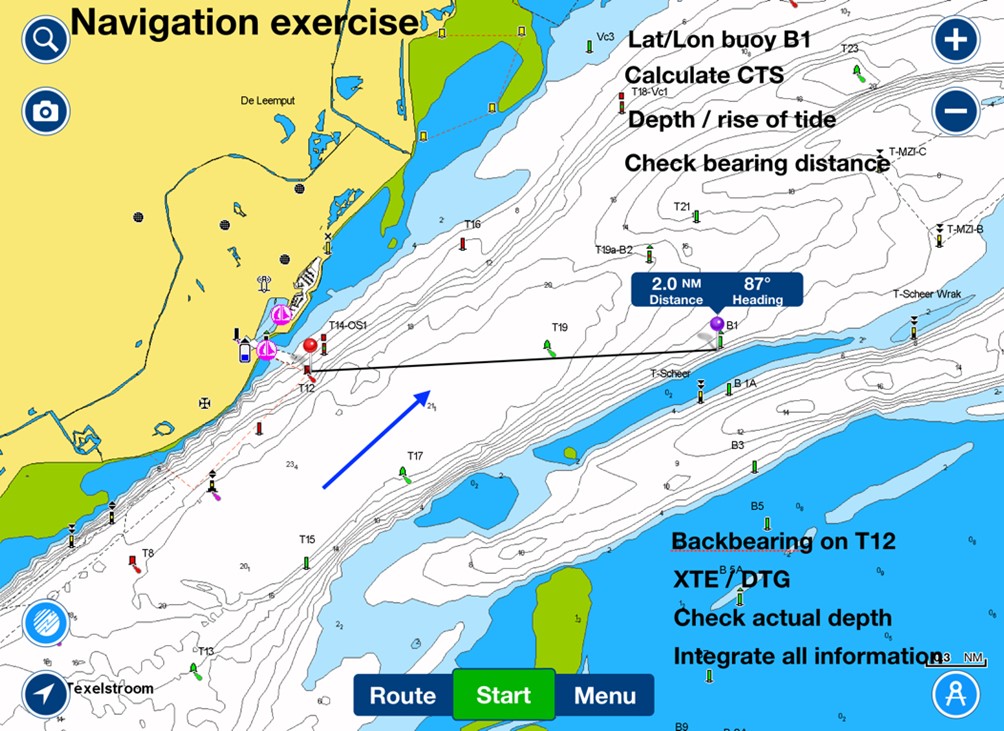
The following exercise helps in integrating traditional navigation tools with gps.
From the chart we find the Lat/Lon of a specific buoy (preferably unlit) and enter this in the gps. On the chart we shape a course from a lit buoy to this specific buoy. Sailing close to the first buoy the bearing/distance from the chart should be the same as the gps indicates.
Calculate the course to steer (CTS) and rise of tide.
Starting from the first buoy set course for the unlit buoy. Initially you can use both the back-bearing and the XTE/DTG from the gps. The navigator steers the yacht using this blend of information. Ideally both the back-bearing and the gps concur. Dead reckoned distance and DTG can be checked enroute. When the buoy on our back-bearing fades in the distance we have checked and tested the information from our gps. Combine this with a depth reading and you have successfully integrated several tools for navigation.
(Article written by Albert de Nijs for Dutch Offshore Sailing Academy / De Zeezeilers.nl).