

Pilot charts (or routeing charts as they are called in the UK) offer a wealth of information, organized per region per month on a chart. They are considered essential for planning a safe and efficient passage.
This is the kind of information that is needed even before you start actually planning a specific voyage, as it will allow you to decide straight away whether your plan is feasible. Once you’ve decided that your plan is feasible, you can proceed to the next stage, and that is to plan a voyage along a route that has the best chance of favorable sailing conditions.Pilot Charts depict averages in prevailing winds and currents, air and sea temperatures, wave heights, ice limits, visibility, barometric pressure, and weather conditions at different times of the year. The information used to compile these averages was obtained from oceanographic and meteorological observations over many decades during the late 18th and 19th centuries.
That also means that recent changes in weather patterns are not included, you’re looking at long term averages. As mariners like to avoid areas with severe weather, these areas might be under-reported.
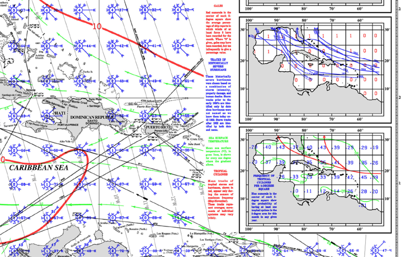
In the previous article we discussed TRS’s. The mean tracks of Tropical cyclones and their frequency can be found on pilot charts.
A quick internet search will yield results for these charts, look for Maritime Safety Information (MSI) North Atlantic Pub #106 (free download) or go to:
https://www.offshoreblue.com/navigation/pilot-charts.php
(Article written by Albert de Nijs for Dutch Offshore Sailing Academy)